 I need to confess. I have a fetish for ancient maps. (Yeah, I know, shocking). I remember some that my father had hanging in the den, and I always loved looking at them. Given the subject period for Felix, I doubt you’ll be surprised at the squeals of glee I emitted when I came across two absolutely amazing and highly useful projects.
First is the Mapping Rome project. While the project builds up multi-layered, sophisticated maps, concentrating on the Forma Urbis Romae – the maps of Rome by Rodolfo Lanciani – it also has links to other mapping projects. All in all, you (well, me) can spend a day clicking and gawking at incredibly rich and detailed maps of the ancient world.

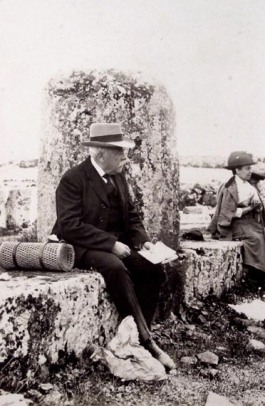
A side note on Lanciani: He was a 19th century Roman archaeologist. His magnum opus was a set of 46 highly-detailed maps of ancient Rome, denoting structures in layers as they were built and rebuilt over time. Though there have been many discoveries since, his maps are still considered unsurpassed.
He is also the one who showed that the destruction of ancient Roman monuments and buildings was not the result of a cataclysmic “sacking” or some natural disasters, but rather a millennia long process where humans treated these monuments as a handy source of quality marble and building materials.
For those looking for another view of mapping, and specifically about travel in the ancient world, Stanford’s project Orbis is an invaluable resource. It simulates travel times and costs across the vast expanse of the Roman empire, overlaid on accurate, modern topological maps. It’s highly interactive, and you can play with parameters to see how would you get from say, Bath in the UK (Aquae Sulis) to Rome – and whether you want to go quickly or cheaply, and depending on the season.
This information was built from a variety of source, not the least of which is the Tabula Peutingeriana. This is 13th century parchment “map” of the official road network of the Roman empire, based on earlier works from the 5th century, which are in turn based on maps dating back to Agrippa’s Roman roads maps of the last century BCE (e.g. it shows Pompeii). It’s not a map in the modern sense, showing exact geography. Rather, it is an itinerarium, showing relative distances as measured in travel times.
You can find an interactive viewer of the map here (because there’s no good way of stuffing 22 feet / 6.75 meters of graphics on to a computer screen).
So, before you go ahead and dive into the rabbit hole of amazingly detailed maps and illustrations, what’s your fetish when it comes to history?
I do love maps! Thank you, Assaph, for sharing this!
LikeLiked by 1 person